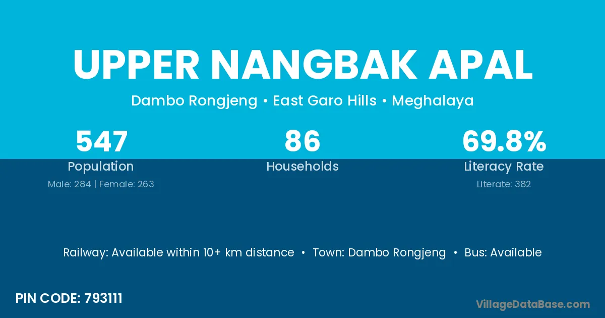
Upper Nangbak Apal village is located in the Dambo Rongjeng Subdivision of the East Garo Hills district in Meghalaya .
Block / Subdivision → Dambo Rongjeng
District → East Garo Hills
State → Meghalaya
According to Census 2011 information, the village code of Upper Nangbak Apal village is 793111.
Upper Nangbak Apal village has a total population of 547 people, of which 284 are males and 263 are females.
The literacy rate of Upper Nangbak Apal village is 69.84%. Male literacy stands at 70.77% and female literacy at 68.82%.
There are approximately 86 households in Upper Nangbak Apal village.
Dambo Rongjeng is the nearest town to Upper Nangbak Apal village for major economic activities
The population of Upper Nangbak Apal village is distributed between literate and illiterate residents as follows:
| Particulars | Male | Female | Total |
|---|---|---|---|
| Literate | 201 | 181 | 382 |
| Illiterate | 83 | 82 | 165 |
| Total | 284 | 263 | 547 |
Source: Census 2011
| Village | District |
|---|---|
| Badilpa Apal | East Garo Hills |
| Diplokgittim | East Garo Hills |
| Diplokgittim | East Garo Hills |
| Gabil Nengtek | East Garo Hills |
| Gabil Patal Upper | East Garo Hills |
| Lower Gabil Patal | East Garo Hills |
| Lower Nongbak Apal | East Garo Hills |
| Mejolgre Wancho | East Garo Hills |
| Mogru | Dakshina Kannada |
| Mogru | East Garo Hills |
| Nengkongkil | East Garo Hills |
| Rangberam | East Garo Hills |
| Rongkinjeng | East Garo Hills |
| Rongkinjeng | East Garo Hills |
No reviews yet. Be the first to review this village!
Available within 10+ km distance
Available within <5 km distance
Available within 10+ km distance