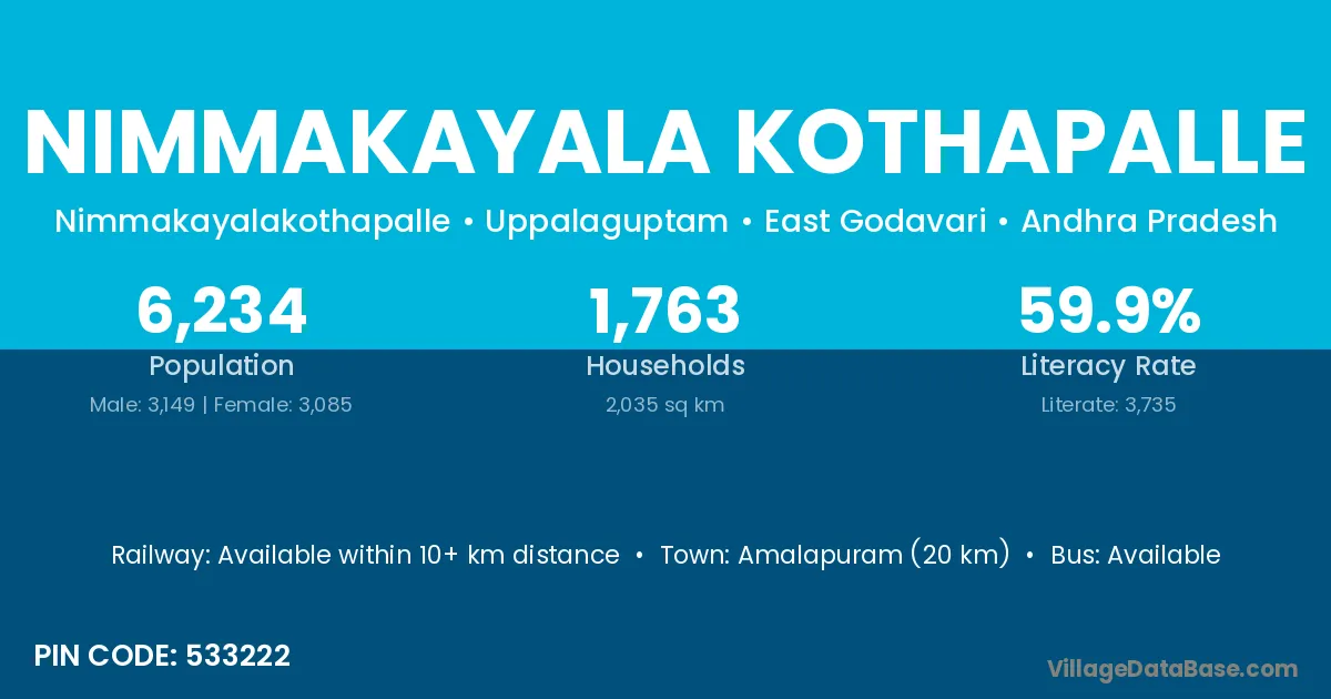
Nimmakayala Kothapalle village is located in the Uppalaguptam Mandal of the East Godavari district in Andhra Pradesh .
Block / Mandal → Uppalaguptam
District → East Godavari
State → Andhra Pradesh
According to Census 2011 information, the village code of Nimmakayala Kothapalle village is 533222.
Nimmakayala Kothapalle village has a total population of 6,234 people, of which 3,149 are males and 3,085 are females.
The literacy rate of Nimmakayala Kothapalle village is 59.91%. Male literacy stands at 65.61% and female literacy at 54.10%.
There are approximately 1,763 households in Nimmakayala Kothapalle village.
Amalapuram (20 km) is the nearest town to Nimmakayala Kothapalle village for major economic activities and is located approximately 20 km away.
The population of Nimmakayala Kothapalle village is distributed between literate and illiterate residents as follows:
| Particulars | Male | Female | Total |
|---|---|---|---|
| Literate | 2,066 | 1,669 | 3,735 |
| Illiterate | 1,083 | 1,416 | 2,499 |
| Total | 3,149 | 3,085 | 6,234 |
Source: Census 2011
No reviews yet. Be the first to review this village!
Available within 10+ km distance
Available within village
Available within <5 km distance